VigiEau smart home integration, free and open source
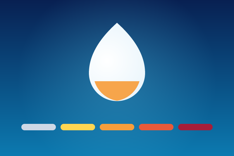
French drought alert levels and water restrictions, from the official VigiEau service.
Published by prohand
- Devices
- Version 3.0.0
- Requires Gladys >=5.1.0
- ★ 1
This integration queries VigiEau, the French government service publishing the drought alert level and the water restrictions in force at a given address, and exposes the result as Gladys sensors.
The VigiEau API is free and public: no account, no API key. It covers France only.
What you get
One device per watched location, named "Vigilance sécheresse — your location", each carrying seven sensors. You can watch up to ten locations: a house, a second home and an allotment garden are rarely under the same prefectoral decree.
| Sensor | Value |
|---|---|
| Drought alert level | 0 to 3 — the worst of the three water types |
| Level (text) | "Alerte renforcée", "Crise"… |
| Surface water level | 0 to 3 — rivers and lakes (SUP zones) |
| Groundwater level | 0 to 3 — aquifers (SOU zones) |
| Drinking water level | 0 to 3 — the tap water network (AEP zones) |
| Dernière mise à jour | "15/06/2026 09:26" — the last successful VigiEau read for this location |
| Arrêté en vigueur depuis | "15/06/2026" — the day the decree setting this level came into force |
The two dates do not say the same thing. VigiEau publishes no timestamp of its own data: nothing in the API says "this information dates from…". So Dernière mise à jour is the moment the integration last queried VigiEau successfully for this location — what tells a frozen sensor from a level that simply has not changed. It only moves on a successful read: after an outage it stays on its previous value, alongside the level. Arrêté en vigueur depuis is a date from the source: the day the applicable prefectoral decree came into force. When nothing is in force, the sensor reads "Aucun arrêté en vigueur" rather than keeping the date of a decree that has been lifted. Both are shown in Paris time, whatever the server's timezone.
The numeric scale follows the prefectoral decrees, folded onto the four values Gladys knows how to name:
| Value | Shown by Gladys | VigiEau level | What it means |
|---|---|---|---|
| 0 | Pas de risque | Pas de restriction | Nothing in force at this address |
| 1 | Faible | Vigilance | Water savings encouraged, no ban yet |
| 2 | Moyen | Alerte | First bans (watering, car washing…) |
| 3 | Élevé | Alerte renforcée or Crise | Wider bans, up to priority uses only |
Gladys can only label a risk level from 0 to 3; anything above shows as "Inconnu". "Alerte renforcée" and "Crise" therefore share the value 3. The Level (text) sensor keeps the exact official wording, "Crise" included — use it to tell the two apart.
A single location can belong to several zones: a decree may restrict groundwater without touching the tap. That is why the three water types are exposed separately, in addition to the overall level.
Configuration
- Open the integration's Configuration tab.
- Click "Add a location (search for an address)", type your address (street, postal code, town) and, if you like, a name ("Maison", "Jardin"… — the town is used when you leave it empty). The location is created, its coordinates are geocoded for you, and its device shows up in the Discovery tab, ready to be added. If you already know the point, fill the optional Latitude and Longitude fields in instead: they are used as they are, with no geocoding.
- Repeat for every location you want to watch, up to ten. If the locations you want are your Gladys houses, the "Add my Gladys houses" button spares you all typing: see "Adding your Gladys houses in one click" below.
- In "General settings", pick your user profile: household, company, local authority or farm. Restrictions differ per profile, and VigiEau returns the ones that apply to yours. This setting applies to every location.
- Leave the refresh interval at 3600 s (1 hour): prefectoral decrees change once a day at most. The integration keeps that pace itself; a 5-minute floor applies whatever you type.
- Save.
Until one location has a usable point, no device is offered. That is deliberate: no device beats a device pinned to an empty location.
Adding your Gladys houses in one click
You have already told Gladys where you live: that is the map in Settings > Houses. The "Add my Gladys houses" button reads those houses and creates a location for each one that is not watched yet — no address to type, no risk of geocoding the wrong town. The location takes the name the house has in Gladys, and the address shown in the listing is looked up for you from the point.
A few rules, which the message under the button repeats every time:
- Reading your houses' coordinates is an authorization. Where you live is personal data: the integration asks for it in its manifest, and Gladys shows you that request when you install it. If the button answers that Gladys refuses to share those coordinates, the installed version never asked for it: update the integration, or remove and re-install it and accept the request.
- A house you never placed on the map has no coordinates. It is named in the answer and nothing is watched in its place: locate it in Settings > Houses, then click again.
- A house already watched is not added twice. Click as often as you like: the message tells you which location already watches it.
- It is not a sync. The houses are read once, when you click. A location created this way is an ordinary one: move the house in Gladys afterwards and the location stays where it was — delete it and click again.
Viewing your locations
Run the "Show the locations" action: the message under the button lists every configured location, numbered, in the form
• number. name — address (latitude, longitude)
The numbers are the ones the "Delete a location" dropdown offers — that is where you read which location "Location 2" is. A location whose coordinates are unusable is listed too, with a dash where its point should be: it is neither published nor queried, and that line is the only thing that says so.
Why does every location run on one single line? The integration does send a real line break between two locations — the container logs show it. The Configuration screen, though, displays an action's answer as the text of a plain alert box, and a browser renders a line break there as a space: no formatting is possible, whatever the integration sends. Hence the "•" opening every location — it is what visibly separates the entries for as long as Gladys collapses the line breaks.
Why a button and not a table on the page? The Configuration screen shows nothing an integration has to say, except the message of an action, under its button — and it only renders input fields, never a read-only text. A list you build as you go has no place there. That is also what makes "Show the locations" always current: there is nothing to reload.
A location cannot be edited. To change an address, add the new location with "Add a location", then delete the old one. What you get is a new device in the Discovery tab: the old one keeps its own history, and a location's name is the one you give it when you create it.
Why the limitation? Editing a location meant designating one on the Configuration screen, and an integration's dropdown can only offer options written in advance in its manifest — never your location names. The fields that followed such a dropdown also kept showing the previous location until the page was reloaded, with the risk of writing one location's address onto another.
Deleting a location
In the "Delete a location" action, pick the number shown by "Show the locations", tick "I confirm the deletion" and run it. Run unticked, it only tells you which location would go.
The locations after the one you delete move up a rank: the message says so. Run "Show the locations" again to see the new numbering before the next deletion.
What happens to the device depends on what you had done with it:
- You never added it (it was only offered in the Discovery tab): it leaves the discovery straight away, the integration having stopped offering it. The message confirms it.
- You had added it to Gladys: it stays, and stops updating. An integration is not allowed to delete a device — Gladys gives it no way to. The message gives you its exact name: delete it yourself from the integration's Devices tab.
Deleting a location does not delete its Gladys device — an integration is not allowed to. Delete it yourself if you no longer want it.
Why an address and not a postal code
The watched location is a precise point, not a commune.
A postal code often covers several communes, and one commune can span several restriction zones for the same water type. That is exactly when VigiEau refuses to answer and asks for your street: the commune code cannot name the applicable zone.
A geocoded point never has that problem — it falls inside exactly one zone per water type. The integration therefore always queries VigiEau by coordinates.
The search button
- Click "Add a location (search for an address)".
- Type your address. The more precise, the better: "12 rue des Lilas, 82000 Montauban" beats "Montauban".
- The integration geocodes it on the official Base Adresse Nationale — the same service the VigiEau website uses — creates the location and publishes its device in the Discovery tab.
When several addresses match with no clear winner, the integration does not guess: it lists the candidates and asks you to be more precise. Add the number, the street or the town, and search again.
The confirmation message shows the address it settled on and its coordinates: check it at a glance before moving on.
Typing a latitude and a longitude yourself
The "Latitude" and "Longitude" fields of the same action are optional. Fill both in and the location is created on that point as it is, with no geocoding: the way out of the cases an address cannot serve — a plot with no street, a hamlet the Base Adresse Nationale does not know, or a point read off a map.
- They are WGS-84 decimal degrees: latitude -90 to 90, longitude -180 to 180. Both the comma and the dot are accepted ("48,8566" as well as "48.8566"), and a value out of range is refused with a message showing what was received.
- Both go together: a latitude alone is not a point, and the action refuses it rather than completing it with a zero — which would have you watching the Gulf of Guinea.
- If you type an address as well, the coordinates win: the address is then only the label "Show the locations" displays (and the name, if you give none). With neither address nor name, the location is named after its own coordinates.
- A point picked off a map is still just a point: check it with "Test the VigiEau connection" right after adding it.
Actions
- Add a location (search for an address) — geocodes the address and creates the location, or creates it straight on the latitude and longitude you type (both optional). See "Why an address and not a postal code" above.
- Add my Gladys houses — reads the houses configured in Gladys and adds a location for each one that is not watched yet, with nothing to type. Requires the authorization accepted at install time.
- Show the locations — lists every configured location, numbered, with its name, address and coordinates. Those numbers are the ones the deletion offers.
- Test the VigiEau connection (all locations) — runs a live request and shows the current level of every location, for the three water types. Use it right after the configuration to check that your locations are covered.
- Show the restrictions in force (all locations) — lists the water usages currently restricted at each address for your profile, with a link to the decree.
- Delete a location — stops watching the location whose number you pick, after confirmation. Its Gladys device stays: delete it yourself. It is the last button of the screen, the only one that destroys anything.
Widgets, scene triggers and scene actions (Gladys 5.1)
Since Gladys 5.1, the integration adds its own cards to the dashboard and its own blocks to the scene editor. They all designate a location by its device: a location whose device you have not added from the Discovery tab yet does not show in those lists.
Dashboard widgets
- Drought watch — one location, picked in the widget's settings: the overall level and the level of each water type (colored dot), the decree date, the time of the last read, the number of restricted uses and their list (tap a use to read the details). Two buttons: View the decree and Refresh.
- Drought: all locations — every location on one card, one colored row each, with the number of locations under restriction (Alerte level or above) and a Refresh button.
The widgets follow the integration's reads, without querying VigiEau every time a dashboard is displayed.
Scene triggers
- The drought level changed — a read gives a location another level than the previous one. Optional filters (empty = any): the location, the new level (the five VigiEau levels, Crise included, which the numeric sensor cannot tell from "Alerte renforcée") and the direction (worsening or easing).
- A new decree is in force — a read finds a prefectoral decree the previous read did not have, even at an unchanged level. Optional filter: the location.
Both hand the following actions the location name, the level in words, the decree link, and so on: insert them in a message with the editor's variable picker ("Location name", "Level (wording)"…).
The first read of a location fires nothing: it sets the reference. That reference survives a restart, so a change that happened during an update of the integration still fires the scene at the next read. A trigger fires at the pace of the reads: at most once per "Refresh interval".
Scene actions
- Read the drought level — queries VigiEau right away for a location and hands the following actions its level (in words, and a 0-4 code where 4 = Crise), the level of each water type, the restricted uses and the decree.
- Check whether a water use is restricted — queries VigiEau for a location
and tells whether a use is restricted: type a word of its French name or
theme ("arrosage", "piscine", "lavage"…). The
Restrictedoutput (true / false) can be tested in a condition of the scene.
These actions publish nothing: they move neither the sensors nor the triggers, so a scene can never restart itself.
Scene ideas
- Stop the automatic watering as soon as "Drought alert level" reaches 1 (Vigilance) or 2 (Alerte), depending on how cautious you want to be.
- Get notified when the level changes: trigger "The drought level changed", then a message carrying the "Level (wording)" and "Decree URL" variables.
- Check before watering: in the watering scene, action "Check whether a
water use is restricted" with "arrosage", then a condition on
Restrictedbefore opening the valve. - Follow the season: the numeric sensors keep their history, so a chart shows the severity climbing through the summer.
Troubleshooting
- No device in the Discovery tab — in order:
- Have you added a location? Without a located location the integration deliberately publishes no device. Use the "Add a location (search for an address)" button; the "Show the locations" action lists what is actually stored.
- Click Scan in the Discovery tab to force a new publication.
- Read the integration logs. A line starting with
Publishedconfirms Gladys accepted the device. If you seePost-connection initialization failedinstead, the message that follows gives the exact reason — it is also shown in the Configuration screen. - Check that the container is actually running: a Docker image that cannot
be pulled (
manifest unknown) stops the integration from starting, and nothing is ever published.
- I would like to correct a location's latitude or longitude — a location is never edited: add a new one, either with a more precise address or by typing the coordinates you want straight into "Add a location", then delete the old one.
- Two "Vigilance sécheresse" devices after changing the address — that was
the case up to version 1.1.1: the device id was built from the coordinates, so
every address created its own device and the previous one stopped refreshing.
The device now follows the address. After the update, the integration keeps
the device you already created, history included — the log line
Keeping the existing identity of drought-zonesays which one. Any other device left over from an older address can be deleted in Gladys. - I cannot find my locations anywhere on the page — that is deliberate: a configuration screen only renders input fields, and shows nothing an integration has to say except the message of an action. Run "Show the locations": the list appears under the button, always current, with nothing to reload.
- The deletion dropdown shows "Location 1", "Location 2"… rather than my names — the options of a dropdown are written in advance in the integration manifest: they can only be numbers. "Show the locations" is what maps a number to a name.
- A device that stopped refreshing after a location was deleted — that is expected: an integration cannot delete a Gladys device, it can only stop offering it. Delete it in Gladys.
- "No recent value" on every feature — right after adding the device this is normal for a few seconds: Gladys drops the states published before the device existed. The integration notices the creation and refreshes straight away. If it is still empty after a minute, use the Test the VigiEau connection action: it queries the API live and shows any error.
- Every feature is called "Risk level" — that is how Gladys displays them: the "Features" list on the device page shows the generic category label, not the name published by the integration. The three text sensors — level (text), last update, decree in force since — share the same fate and carry an identical generic label. In order they are: overall level, text, surface water, groundwater, drinking water, last update, decree in force since. On a dashboard or in a scene, they all do show their real names.
- "VigiEau cannot tell which zone applies here" — the configured point does not fall inside a single zone. The message names the location: add it again with a more precise address (number and street rather than just the town name), then delete the old one.
- No data / errors in the logs — start with the Test the VigiEau
connection action. A
VigiEau HTTP 5xxerror means the service is temporarily unavailable: it is shown in the Configuration screen, and the integration retries at the next refresh without giving up. - The values do not refresh every minute — that is expected. The device does not use Gladys' polling mechanism (capped at one minute): the integration refreshes on its own at the configured interval, immediately on connection and then hourly by default.
- All levels at 0 — that is the normal answer when no restriction zone covers the address (VigiEau only covers France).
- The level stopped moving although the API changed — the integration never
publishes a value it did not understand, so it cannot wrongly announce "no
restriction". The logs then carry a
VigiEau returned an unknown severitywarning.
The integration logs everything it does: read its logs from the Gladys interface
(or docker logs on the host) with LOG_LEVEL=debug for the full detail,
including the URL being called.
Data source
Data comes from VigiEau, operated by the French Ministry for Ecological Transition. It is provided for information only: in case of doubt, the prefectoral decree published by your prefecture prevails.
Configuration settings
These are the settings VigiEau asks for in its configuration screen in Gladys.
| Setting | Type | Required | Description |
|---|---|---|---|
| Getting started | section | No | VigiEau is the French government service publishing the drought alert level and the water restrictions in force at a given address. The API is free and needs no account: just tell the integration which location to watch. |
| General settings | section | No | These two settings apply to every watched location. |
| User profile (all locations) | select | Yes | Restrictions differ per profile: VigiEau returns the ones that apply to yours. |
| Refresh interval (s) | number | No | How often the integration queries VigiEau, in seconds. Prefectoral decrees change once a day at most: one hour is plenty. |
How to install VigiEau in Gladys
- In Gladys, open Integrations: VigiEau appears in the catalog, next to the native integrations, with a community badge.
- Click Install. Gladys pulls the Docker image (
ghcr.io/prohand/gladys-vigieau:3.0.0), starts it in a sandbox isolated from the core, and generates the integration's interface (devices, discovery and configuration). - Open the Configuration screen of the integration, fill in the settings, and save.
- You can also install it directly from its repository URL: https://github.com/prohand/gladys-vigieau.
VigiEau requires Gladys >=5.1.0. The catalog inside Gladys refreshes every hour, so a new version becomes available at most one hour after its release.
Not running Gladys yet? It is free and open source: follow the installation guide to get started.
About external integrations
VigiEau is an external integration: a community integration packaged as a Docker container and published on GitHub, that Gladys installs in one click and runs in a sandbox isolated from its core. It is published and maintained by prohand, not by the Gladys core team.
- Browse all external integrations
- Discover the native integrations built into Gladys
- Build and publish your own external integration
- Source code on GitHub — source of this documentation