EFFIS smart home integration, free and open source
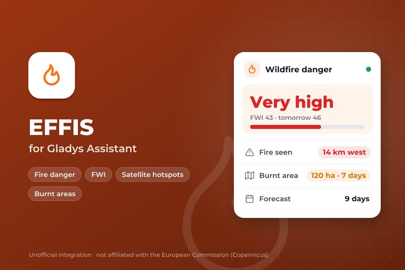
Wildfire danger forecast, fires seen by satellite and burnt areas near your home (Copernicus).
Published by William-De71
- Devices
- Version 0.1.0
- Requires Gladys >=5.3.0
- ★ 0
Overview
EFFIS, the European Forest Fire Information System of the Copernicus Emergency Management Service (European Commission), in Gladys. For each of your places (up to three):
- the fire danger of today and of the next 9 days: the Fire Weather Index (FWI) of the EFFIS forecast and its level, from low to very extreme;
- the fires seen by satellite in the last 24 hours within a radius you choose (MODIS, VIIRS and Sentinel-3 hot spots);
- the burnt areas EFFIS mapped in the last 7 days within that radius.
No account, no key: EFFIS data is open data under the CC BY 4.0 licence. This is not an official alert service: a fire seen by satellite can be a farm burn or an industrial heat source, and a missing detection does not mean there is no fire. Always follow the instructions of the authorities.
Requirements
- Gladys Assistant 5.3.0 or later.
- A house located in Gladys (Settings > Houses), or the coordinates of the place to watch.
- Internet access from Gladys: the data comes from the EFFIS servers.
Configuration
- Install the integration from Integrations (EFFIS).
- For each place, choose a House, or type coordinates ("43.2965, 5.3698"; they win over the house).
- Choose the radius around each place, then save. Check the places shows the coordinates used and what EFFIS says there now.
- In the Discover tab, add the devices you want.
| Field | Default | What it does |
|---|---|---|
| House | A house of Gladys: its location is used. | |
| Or coordinates | Latitude, longitude: a second home, a forest nearby. Win over the house. | |
| Radius | 25 km | Fires and burnt areas are watched within this distance (10, 25, 50 or 100 km). |
| Language | Automatic | Feature names, scene texts and status. |
Usage
Devices
One device per place, "EFFIS <place>", read-only:
- Fire Weather Index: the FWI of today, rounded.
- Fire danger today and Fire danger tomorrow: 0 low (FWI under 11.2), 1 moderate, 2 high (from 21.3), 3 very high (from 38), 4 extreme (from 50), 5 very extreme (from 70), the classes of the EFFIS maps.
- Fires nearby (24 h): the fires seen by satellite within the radius. Hot spots closer than 2 km are counted as one fire.
- Situation: the danger and the nearest fire, as a sentence.
The forecast is read every 3 hours and at each new day, the hot spots every 30 minutes, the burnt areas every hour.
Scenes
Triggers:
- Fire danger level changed: when the level of today changes (a new forecast, or a new day). Filters: device, new level, rises or falls.
- Fire detected nearby: a fire seen by satellite within the radius, not seen before. Variables: distance, direction, time, hot spots, position.
- Burnt area mapped nearby: a burnt area mapped by EFFIS within the radius. Variables: area in hectares, municipality, province, country, fire date, distance.
The first reading after a start is a reference: no trigger replays a fire or a level already there.
Action Get the fire danger (today, tomorrow or the day after): FWI, level, fires nearby, nearest fire, and a summary sentence.
Examples:
- "Fire danger level changed", level very high, extreme or very extreme → send "{{triggerEvent.data.summary}}" and turn the garden watering on in the evening.
- "Fire detected nearby" → send "{{triggerEvent.data.summary}}" to the family.
- Every morning at 7:00 (scheduled scene) → "Get the fire danger" (today) → send its summary when the level is high or more.
Widgets
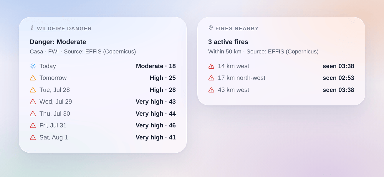
- Wildfire danger: the level of today and of the next days (3 to 9, setting "Days"), with the FWI.
- Fires nearby: the fires seen by satellite in 24 hours (distance, direction, time) and the burnt areas mapped in 7 days (municipality, area, distance, date).
Both credit the source, as the licence of EFFIS asks.
Troubleshooting
- "The house has no position": locate the house in Settings > Houses, or type coordinates.
- "Coordinates not understood": type the latitude, then the longitude, in decimal degrees: "43.2965, 5.3698".
- "EFFIS does not answer for now": the EFFIS servers are busy or in maintenance; the integration tries again by itself and keeps the last data.
- A fire on the EFFIS map but not in Gladys: the satellites pass a few times a day, and clouds or smoke can hide a fire; EFFIS maps a burnt area from the satellite images, usually a day or more after the fire.
- Logs: the Logs tab of the integration. In developer mode,
DEBUG=gladys-integration-sdkadds the SDK logs.
Configuration settings
These are the settings EFFIS asks for in its configuration screen in Gladys.
| Setting | Type | Required | Description |
|---|---|---|---|
| EFFIS, Copernicus | section | No | The data comes from EFFIS, the European Forest Fire Information System of the Copernicus Emergency Management Service (European Commission), open data under CC BY 4.0: no account, no key. For each place: the Fire Weather Index forecast for 9 days, the fires seen by satellite in the last 24 hours and the burnt areas EFFIS mapped in the last 7 days. Fires seen by satellite include farm burns and industrial heat: a detection is not a confirmed wildfire. This is not an official alert service: follow the instructions of the authorities. |
| Places | section | No | Choose a house of Gladys, or type coordinates. Each place becomes a device in the Discover tab. Up to three places. |
| House | select | No | Its location in Gladys (Settings > Houses) is used. |
| Or coordinates | string | No | Latitude, longitude. Win over the house (a second home, a forest nearby). |
| Place 2 | section | No | |
| House | select | No | Its location in Gladys (Settings > Houses) is used. |
| Or coordinates | string | No | Latitude, longitude. Win over the house (a second home, a forest nearby). |
| Place 3 | section | No | |
| House | select | No | Its location in Gladys (Settings > Houses) is used. |
| Or coordinates | string | No | Latitude, longitude. Win over the house (a second home, a forest nearby). |
| Options | section | No | |
| Radius around each place | select | No | Fires and burnt areas are watched within this distance. |
| Language of the texts | select | No | Feature names, scene texts and status. Automatic: the language of your dashboard once a widget has been shown. |
How to install EFFIS in Gladys
- In Gladys, open Integrations: EFFIS appears in the catalog, next to the native integrations, with a community badge.
- Click Install. Gladys pulls the Docker image (
ghcr.io/william-de71/gladys-effis:0.1.0), starts it in a sandbox isolated from the core, and generates the integration's interface (devices, discovery and configuration). - Open the Configuration screen of the integration, fill in the settings, and save.
- You can also install it directly from its repository URL: https://github.com/William-De71/gladys-effis.
EFFIS requires Gladys >=5.3.0. The catalog inside Gladys refreshes every hour, so a new version becomes available at most one hour after its release.
Not running Gladys yet? It is free and open source: follow the installation guide to get started.
About external integrations
EFFIS is an external integration: a community integration packaged as a Docker container and published on GitHub, that Gladys installs in one click and runs in a sandbox isolated from its core. It is published and maintained by William-De71, not by the Gladys core team.
- Browse all integrations, native and community
- Build and publish your own external integration
- Source code on GitHub — source of this documentation